
Woodland Map
Updated July 2025
Access to the Woodland Glades and Rills
Access to the woodland is via a shared entrance with the Equestrian Centre. Pass through the main gates and keep to the right. After approximately 100 yards you will see our large sign, just keep going until you reach our car park.
We ask that most people leave their cars in the car park, but a gravel road does continue into the heart of the woodland for hearses, maintenance vehicles and vehicular access for those less able bodied.
Note. Please do not drive on the grass as it obviously causes severe damage to the surface and drainage. During the winter months the problem is compounded by the Bedford Clay which slows drainage causing pools of water and very wet conditions that easily trap any vehicle!
Clothing and Footwear - This is a natural woodland and conservation area. Please ensure that you always wear appropriate clothing and footwear, especially in cold and wet conditions. Wheelchair access in the wet is not recommended unless you have hired an all terrain wheelchair.
Additional Maps and Information
Office Location: View contact details and office location on Google Maps
Woodland Location: Obtain directions and view the location of the woodland on Google Maps.
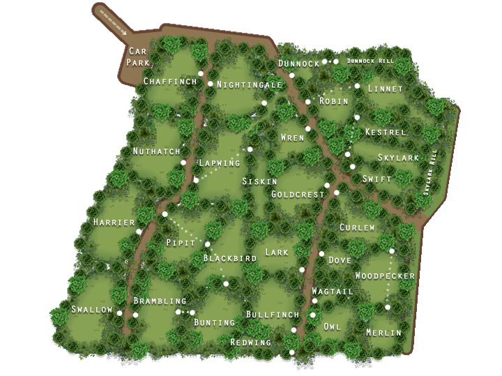
The above map is a very simplistic guide of the woodland, its glades and rills. It is not exact or to perfect scale, but it will help you get around if you do not know the area. It represents a large 12 acre site which is always growing and as such is regularly updated. You can download a copy of the above map using the link provided. This will download a copy to your device for referral or printing later.

